Download SAS Planet 2024 ecplore High-Resolution Satellite Images & Maps ASPlanet offers access to a wide range of map sources including Navionics
Dwonload the latest version of SAS Planet 2024 updated version
In today's digital age, exploring the world has become easier than ever before. Thanks to advanced mapping technologies and satellite imagery, we can virtually traverse the globe from the comfort of our own home. SASPlanet is one such software that enables users to access high-resolution satellite imagery and maps from various sources. In this article, we'll delve into the process of downloading SASPlanet software, its features, and how you can use it to embark on virtual adventures across the planet.
Why Choose SAS Planet?
SASPlanet stands out among mapping software due to its versatility and extensive database of maps and satellite imagery. Whether you're a geography enthusiast, a traveler planning your next adventure, or a researcher in need of geographic data, SASPlanet provides a comprehensive solution.
Features of SASPlanet:
Extensive Map Sources:
SASPlanet offers access to a wide range of map sources including Navionics Google Maps, Bing Maps, OpenStreetMap, and many more. Users can seamlessly switch between different map providers based on their preference or specific needs.
High-Resolution Satellite Imagery:
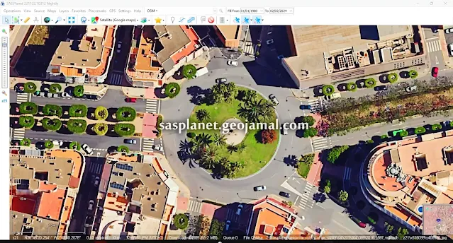
One of the standout features of SAS Planet is its access to high-resolution satellite imagery. Whether you're exploring urban landscapes or remote wilderness areas, SASPlanet provides crisp and detailed imagery for enhanced exploration.
Offline Mode:
SASPlanet allows users to download maps and satellite imagery for offline use. This feature is particularly useful for travelers or researchers who may not always have access to an internet connection.
Geospatial Tools:
SASPlanet comes equipped with various geospatial tools that enable users to measure distances, calculate areas, and perform other analytical tasks directly within the software interface.
Customization Options:
From adjusting map layers to annotating maps with markers and labels, SASPlanet offers a range of customization options to tailor the viewing experience according to individual preferences.
Downloading SASPlanet:
To download SAS Planet, you can obtain the latest version by following these steps:
Dwonload the latest version of SAS Planet 2024 updated version
1 - Update from Older Version:
If you already have a previous version installed, you can check for updates by selecting the "Check for Updates" option from the "Help" menu in the toolbar. However, it's possible that you may encounter a map error after running SAS Planet. In such cases, you can download and utilize the SAS Planet patch from the link provided below.
- Download SAS Planet maps error patch: [ Download Link ]
2 - Download the Free Version:
Alternatively, you can download the free version directly from our website using the link provided. If you encounter a map error message after running the application, you can use the patch available at the provided link.
- Download SASPlanet: [ Download Link ]
- Download SASPlanet maps error patch: [ Download Link ]
3 - Download the full version of SASPlanet with fixed map error
- Download SASPlanet [with fixed map errors]: [ Download Link ]
- сас планета онлайн карта sas planet скачать sas planet скачать
With its extensive map sources, high-resolution satellite imagery, and user-friendly interface, SASPlanet is a valuable tool for anyone interested in exploring the world from their desktop. Whether you're planning a trip, conducting research, or simply satisfying your curiosity, SASPlanet empowers users to embark on virtual journeys across the globe with ease. Download SAS Planet today and start discovering the world like never before!*
See more
How to change the map projection in SASPlanet
Unlock Your World: Change SASPlanet Language in a Snap
Urban Planning & GIS: Maximize Image Resolution with SASPlanet
Credit: sasgis.org
"Tell us about your challenges or learning objectives, and leverage SAS Planet to address them effectively."


