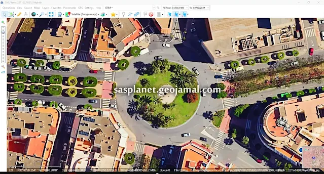
SAS Planet shines brightly, offering access to high-resolution satellite imagery and maps. Download SAS Planet Latest Version with Fixed Map Errors
SAS Planet shines brightly, offering access to high-resolution satellite imagery and maps from various sources. This article will guide you through downloading the latest version of SASPlanet, highlighting its features and explaining how it can transform your virtual adventures. In today’s digital era, exploring our planet is just a few clicks away, thanks to cutting-edge mapping technologies and satellite imagery.
Why SASPlanet is the Premier Choice for Satellite Imagery?
SASPlanet excels as a top-tier mapping software due to its unmatched flexibility and vast repository of maps and satellite imagery. Whether you are a geography enthusiast exploring new landscapes, a traveler preparing for an upcoming adventure, or a researcher seeking accurate geographic data, SAS Planet provides a robust and all-encompassing platform tailored to meet your specific requirements.
Key Features of SASPlanet
1. Diverse Map Sources: SASPlanet provides users with access to a broad spectrum of map sources, including popular options like Google Maps, Bing Maps, and OpenStreetMap, among others. This flexibility allows users to seamlessly switch between different map providers, making it easy to find the most relevant and accurate information for their specific needs.
2. High-Resolution Satellite Imagery: A standout feature of SAS Planet is its provision of high-resolution satellite imagery. Whether you’re navigating through bustling cityscapes or exploring untouched natural landscapes, SASPlanet offers sharp and detailed images that enrich your virtual exploration.
3. Offline Accessibility: SASPlanet supports downloading maps and satellite imagery for offline use, making it an ideal tool for travelers and researchers who might not always have a stable internet connection. This offline mode ensures that your exploration and research can continue uninterrupted, regardless of your location.
4. Comprehensive Geospatial Tools: SASPlanet comes equipped with a suite of geospatial tools that allow users to measure distances, calculate areas, and perform various analytical tasks directly within the software. These features make SAS Planet an essential tool for detailed research, planning, and analysis.
5. Extensive Customization Options: SAS Planet offers a wide range of customization features, from adjusting map layers to adding annotations with markers and labels. These options enable users to personalize their viewing experience, ensuring that the exploration is tailored to their unique preferences and objectives.
How to Download the Latest Version of SAS Planet
Here are the steps to download and install the latest version of SASPlanet:
1. Update from an Older Version: If you already have a previous version installed, check for updates by selecting the “Check for Updates” option from the “Help” menu in the toolbar. If you encounter a map error after updating, you can download the SASPlanet patch using the link below:
- Download SASPlanet maps error patch: [ Download Link ]
2 - Download the Free Version: Alternatively, you can download the free version directly from our website using the link provided. If you encounter a map error message after running the application, you can use the patch available at the provided link.
- Download SASPlanet: [ Download Link ]
- Download SAS Planet maps error patch: [ Download Link ]
3. Download the Full Version with Fixed Map Errors: For a seamless experience, download the full version of SASPlanet with fixed map errors using the link below:
- Download SAS Planet [with fixed map errors]: [ Download Link ]
- сас планета онлайн карта sas planet скачать сас планета скачать
Discover the World with SASPlanet: Your Gateway to High-Resolution Satellite Imagery
SASPlanet is a powerful tool designed for those who want to explore the world from the comfort of their desktop. With access to extensive map sources and high-resolution satellite imagery, SAS Planet is perfect for planning trips, conducting research, or simply satisfying your curiosity about our planet. Its user-friendly interface makes virtual exploration effortless and enjoyable.
Additional Resources
- Unlock Your World: Change SAS Planet Language in a Snap
- Urban Planning & GIS: Maximize Image Resolution with SAS Planet
Credit: sasgis.org
Tell us about your challenges or learning objectives, and leverage SASPlanet to address them effectively.


