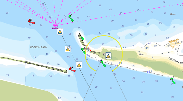
the most popular navigation apps in the market today are Aqua Map and Navionics. Both offer a range of features that appeal to different users
Marine navigation has evolved with technology, making it easier for boaters, anglers, and marine enthusiasts to chart their courses and explore new waters with precision. Two of the most popular navigation apps in the market today are Aqua Map and Navionics. Both offer a range of features that appeal to different users, but which one should you choose? In this article, we’ll break down the key differences, similarities, and features to help you decide which is the better fit for your needs.
What is Aqua Map?
Aqua Map is a powerful marine navigation app that offers detailed offline charts, AIS (Automatic Identification System) integration, and other advanced features. Designed for both recreational and professional sailors, it boasts a user-friendly interface, making it a favorite among many boaters. Aqua Map's offline capabilities allow you to download charts and navigate without an internet connection, an essential feature when you're far from shore.
Key Features of Aqua Map:
- Offline Charts: Download and store charts on your device to use them when you're out of range.
- AIS Integration: View other vessels in real-time for safer navigation.
- Anchor Alarm: Alerts you if your anchor starts to drag.
- Route Planning: Easily plan your trips and calculate routes.
- Seamless Integration with External Devices: Aqua Map works well with external GPS devices for improved accuracy.
What is Navionics?
Navionics has long been a trusted name in marine navigation, offering detailed charts and a suite of tools for boaters, anglers, and divers alike. Its charts cover not only coastal areas but also inland waters, making it versatile for different types of water activities. Navionics' frequent updates ensure that users always have the latest information at their fingertips.
Key Features of Navionics:
- Community Edits: Benefit from user-generated content to stay up-to-date with local knowledge.
- SonarChart™: Get detailed depth information based on real-time sonar data.
- Advanced Map Overlays: View weather, wind, and tide information.
- Cross-Platform Sync: Sync your charts and routes across multiple devices.
- Free Trial: Navionics offers a free trial for users who want to test the app before committing.
Feature Comparison: Aqua Map vs. Navionics
| Feature | Aqua Map | Navionics |
|---|---|---|
| Offline Charts | Yes | Yes |
| AIS Support | Yes | No |
| Community Edits | No | Yes |
| Advanced Weather Info | No | Yes |
| SonarChart™ | No | Yes |
| Anchor Alarm | Yes | No |
| Price | One-time purchase for maps | Subscription-based |
Which One Should You Choose?
When it comes to choosing between Aqua Map and Navionics, it really depends on your needs and how you plan to use the app. If you’re looking for detailed charts with community contributions and seamless syncing between devices, Navionics might be the best choice for you. It’s particularly suited for users who need constant updates and love community-sourced information.
On the other hand, if you prioritize offline navigation, need AIS integration, and prefer a one-time purchase for charts instead of subscriptions, Aqua Map might be a better fit. It’s particularly helpful for long voyages where internet connectivity is not guaranteed.
Using These Tools with SAS Planet
For users of SAS Planet, integrating your marine charts with these apps adds another layer of functionality. With SAS Planet, you can download high-resolution satellite imagery and overlay it on your charts for more precise navigation. Whether you're using Aqua Map or Navionics, SAS Planet allows you to enhance your charting capabilities by combining maps from various sources, giving you a clearer picture of the waters ahead.
Both Aqua Map and Navionics are excellent tools, each catering to slightly different needs. If offline navigation and AIS are critical for your sailing adventures, Aqua Map is the way to go. If you’re more into frequent updates, community edits, and cross-platform syncing, Navionics will serve you well.
Whichever you choose, integrating your navigation tools with platforms like SAS Planet will only enhance your overall experience, giving you even more data to navigate safely and confidently.


